Press release 2019-02-08 at 9:04
Press release of the Finnish Environment Institute (SYKE), the Finnish Meteorological Institute, the Natural Resources Institute Finland, Metsähallitus, the Geological Institute of Finland, the Finnish Heritage Agency, the Brahea Centre at the University of Turku, the maritime spatial planning coordination group and the Government of Åland.
Will your boat trip take you past any places of interest? Where are the nearest guest harbours? What will the weather conditions be like for sailing? Has any cyanobacteria been spotted in the sea near your holiday home? For the answers to these questions and many more, visit Seaguide.fi, a new online service.
The Seaguide.fi service will be presented at the Helsinki International Boat Show, which opens today (8 February).
Seaguide.fi is a new map for boaters, people with holiday homes and anyone on the coast. The service provides information generated by several Finnish organisations on topics such as the weather and conditions at sea, restricted areas of various types, guest harbours, amounts of cyanobacteria and places of interest to visitors. It also offers photographs, satellite imagery and many other types of interesting information for mariners.

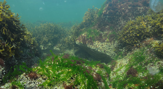
Seaguide.fi offers photographs, satellite imagery and many other types of interesting information for people interested in marine matters. © Mats Westerbom / Metsähallitus
Seaguide.fi is a browser-based service that also works on mobile devices. The service works on the Chrome, Firefox, Safari and Edge browsers. The service is available in three languages: Finnish, Swedish and English.
Finnish marine data in one place
The Seaguide is the first part of the Finnish Marine Portal project, which will improve the accessibility of marine data generated in Finland. The aim is to create a national service that brings together the data and material created by various organisations in the marine sector to make marine data and material easier to find and use. The Marine Portal website and a service for downloading marine data will be launched in late autumn 2019 at the address, itämeri.fi.
The portal will make it easier for different user groups to obtain the marine data they need. The project focuses on visual clarity, the functionality of search paths and user interfaces, and the ability to download data. It will offer information such as real-time marine data, maps, downloadable research data, information about the state of the Baltic sea and teaching material. The portal is being developed in close interaction with various user groups.
The Marine Portal is being implemented by ten organisations, thereby promoting collaboration between data producers and harmonisation of data material. The portal is being realised by the Finnish Environment Institute (SYKE), the Finnish Meteorological Institute, the Natural Resources Institute Finland, Metsähallitus, the Geological Institute of Finland, the Finnish Transport and Communications Agency Traficom, the Finnish Heritage Agency, the Brahea Centre at the University of Turku, the maritime spatial planning coordination group and the Government of Åland. The portal is financed by the European Maritime and Fisheries Fund. The Seaguide.fi is developed by Fleetrange Ltd.
For further information, please contact
Hanna Piepponen, Project Coordinator, Finnish Environment Institute (SYKE), tel: +358 40 1823334, email: firstname.lastname@ymparisto.fi
seaguide.fi
sea-guide.fi
havsguiden.fi
meriopas.fi
The Seaguide will be presented at the Helsinki International Boat Show, 8–17 February 2019 (Uusi Aalto area, stand 1 F 5)