Built environment information systems are developed and maintained to support land use planning, monitoring and research, and participatory planning processes.
© Picture: ChengXi Zhang (pngtree.com)
The environmental administration operates several built environment information systems: Liiteri information service, the local master plan database (fin. Yleiskaavapalvelu) and the interfaces for saving land use planning information. These interfaces include TYVI-service for storing forms for monitoring local detailed plans, geographical information system for municipal land use planning and cultural environment (GISALU), and statistics of land use planning.
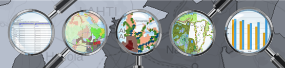
The built environment information system entity collects and provides nationwide material especially for facilitating the implementation of the Land Use and Building Act. The GIS data and statistics, produced in cooperation with various parties, provide a diverse outlook on the built environment and land use plans and decisions.
All GIS data and statistics concerning land use planning, urban and spatial structure, and living environment are available in Liiteri-service. Regional divisions of built environment and GIS data are also available in the environmental administration’s other map and information services. The information is provided for internal use in environmental administration as well as for external use.
Additional information
Questions related to land use information systems at the Finnish Environmental Institute: