ICP IM site FI04
|
|
|
|
|
|
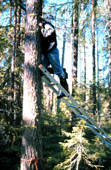
Monitoring of epiphytes at the Pesosjärvi
catchment, photo Aira Kokko.
|
|
General features
The total area of Peosjärvi monitoring area is about 630 ha, making it the largest of the Finnish sites belonging to the ICP IM network. It is long and narrow in shape. In addition to Lake Pesosjärvi, there are several smaller lakes, ponds and brooklets in the area. The total water area is about 9% of the entire catchment. Due to the large size of the area, the catchment has been divided into two areas with most of the monitoring activities concentrated in the eastern part.
The Pesosjärvi site is part of the Kitkanniemi area which was incorporated into Oulanka National Park in 1989. The monitoring area is largely undisturbed except for the northwestern corner of the catchment, which was clear cut at the end of 1980s.
The forests are mainly mature or old, and the tree trunks display signs of forest fires that occured at the turn of the century. Along the banks of brooklets there are meadows which have been harvested in the past for cattle feed.
Collecting of bulk deposition started in 1988, and most of the other ICP IM subprogramme began one year later. In autumn 1989 a European Monitoring and Evaluation Programme (EMEP) station was established in the vicinity of the IM area to monitor deposition, suspended particles and gaseous compounds. An intensive two-year study of the hydrobiology of the lake was contucted in 1992-1993.
Full monitoring in accordance with IM programme at Pesosjärvi (Kainuu) and Vuoskojärvi (Lapland) sites stopped in 1999, and monitoring was carried out with limited programme between 2000 and 2015.
|
Country:
|
Finland
|
|
Province/Municipality:
|
Kainuu / Kuusamo
|
|
Area of site (hectares):
|
630
|
|
Location (Lat/Long):
|
66° 17' N, 29° 31' E
|
|
Elevation (above sea level):
|
Min: 256 m
Max: 300 m
|
|
Annual mean precipitation:
|
571 mm
|
|
Annual mean temperature:
|
-0.5 °C
|
|
Dominant vegetation:
|
Mesic heath forests
|
|
Dominant soil type:
|
Histosols cover 1/5 of the area, most of the non-organic soils are podzols
|
|
Biotopes (hectares):
|
Upland forest 382, peatlands 123, unmapped area outside the national park 66, lake and ponds 57
|
Geology and soils
The Pesosjärvi monitoring area is situated in a contact zone with quartzites and basic volcanic. Arkosic and sericite quartzites dominate the northeastern half of the catchment, and massive basaltic lavas with thin tuff interlayers dominate in the southwestern half. In the contact zone, carbonate minerals occur regularly, both in volcanics and in quartzites, especially in the bottom part. The Pesosjärvi catchment follows to the above-mentioned contact zone which, due to the presence of carbonate-rich rock types with low abrasion resistance, is eroded deeper than the surrounding area. Consequently the glacial till of the overburden is more calcareous than normal. The strike of the bedrock in the area is roughly from northwest to southeast. The dip of the schistocity is generally 40-70° to the southwest.
The ice flow direction during the last Ice Age was approximately from northwest to southeast. The bedrock is covered by till deposits. The area is supraaquatic and little washing from of the till has taken place. Weathered bedrock can propably be found in the distal slopes of the hills and in valleys.
Peatland cover about 123 hectares and histosols can be assumed to account for about a fifth of the soils in the area. All the permanent plots on mineral soil have been classified as podzols, and most of the nonorganic soils in the area are also expected to be podzols.
Vegetation
Like the vegetation in Kuusamo area in general, the vegetation of the Pesosjärvi monitoring site is diverse and rich. This is due to the presence of calcareous material in the till covering the catchment. There are about 60 different vegetation site types, and most are mires (see Eurola et al. 1984, for mire types). The number of plant species, including some classified as threatened, is very high.
In terms of geobotanical zonation (Ahti et al. 1968) the area belongs to the slightly oceanic subzone of the northern boreal zone. The forest vegetation consists of coniferous forest typical of northern Ostrobothnia.
The dominant forests are mesic heath forests. Several small stands of rich heaths and herb-grass forests also occur in the catchment (Hämet-Ahti 1989, forest site types).
Rich mire vegetation is typically concentrated in the valleys along the brooksides and around ponds. Poorer mire vegetation occurs especially on the mire margins and on the upper parts of the hills. Spruce mires and thin-peated forests appear as narrow belts in the depressions of hill slopes. Pine mires and bogs occur in the mire areas on the hill slopes and in mire margins. Carex globularis pine mires are typical of the Pesosjärvi area. Rich combination types, birch-spruce mires with rich fen features and rich pine fens are also very common. There are many springs and seepage areas in this area and most are mesoeutrophic. Their influence on the mire types is apparent. Local variants e.g. Carex lasiocarpa-Scorpidium flark fens, have been described for these mire types.
Areas of forest site types in Pesosjärvi Integrated Monitoring area
|
Mesic heath forests
|
367 ha
|
|
Rich heath forests
|
6.5 ha
|
|
Herb-grass forests
|
6.1 ha
|
|
Submesic heath forests
|
2.2 ha
|
Areas of mire types in Pesosjärvi Integrated Monitoring area
|
Birch-spruce mires with rich fen features
|
20.7 ha
|
|
Pine bogs and poor pine fens
|
18.9 ha
|
|
Rich fens
|
17.0 ha
|
|
Poor fens and poor flark fens
|
16.0 ha
|
|
Spruce-pine and pine mires
|
15.9 ha
|
|
Thin peated forests
|
14.4 ha
|
|
Rich pine fens
|
10.1 ha
|
|
Birch-spruce and spruce mires and poor birch fens
|
9.6 ha
|
Maps
FI04 Basemap
FI04 Soilmaterial
References
Ahti, T., Hämet-Ahti, L. & Jalas, J. 1968: Vegetation zones and and their sections in northwestern Europe. - Ann. Bot. Fennici 5:169-211.
Bergström, I., K. Mäkelä and M. Starr (eds), 1995. Integrated Monitoring Programme in Finland: First National Report. Ministry of the Environment, Environment Policy Department, Helsinki. Rep. 1.
Eurola, S., Hicks, S. & Kaakinen, E. 1984: Key to Finnish mire types.In: Moore, P. (ed), European mires: 11-117. Academic Press, London.
Hämet-Ahti, L. 1989: The main features of Finnish vegetation. In: Alalammi, P. (ed), Atlas of Finland. Folio 141-143, Vegetation and Flora:1-2. National Board of Survey, Geographical Society of Finland.