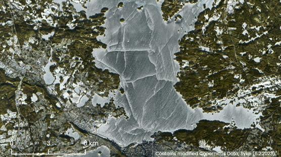
Figure 1. Satellite image of Lake Näsijärvi in full ice cover in February 2023.
Objectives
Exploiting the full potential of Copernicus (European Earth observation programme) data and information services is one of the major objectives of EEA-Eionet Strategy 2021-2030 to improve data and knowledge. Satellite-based Pan-European High Resolution water, snow and ice (HR-WSI) Copernicus Land Monitoring Service CLMS products are developed by Lot 1 of this project (a follow-on project to Copernicus High-resolution Snow&Ice Monitoring). The objective of Lot 2 (led by Syke, NORCE as a partner) is to independently and timely validate the products, as well as to evaluate the applicability and readiness of the production and dissemination software components developed, verified, documented, and implemented by the Lot 1 contractor.
Implementation
Syke will contribute in particular to the validation of snow and ice products and the technical production processes. Also, review of technical documentation provided by Lot 1 is an important part of the work.
Outputs
Main outputs are:
- Reference data (in-situ, modelled data) exploited in the validation
- Validation results for each product published in the Validation report (including validation methodology)
- Review of the Algorithm Theoretical Basis Document (ATBD) and Product User Manual (PUM)
- Validated technical production processes
- Guidance and recommendations.
The services shall enable customer to decide if the HR-WSI production and dissemination system and all related elements such as documentation can be approved, and the operational HR-WSI production and dissemination activities can start.
Impact and implementation
The validation service (Lot 2) provides substantial support to setting up an advanced Pan-European Water, Snow, and Ice monitoring service by making effective use of existing infrastructures in accordance with the INSPIRE Directive. In the global context, the monitoring services form an integral part of the Global Earth Observation System of Systems (GEOSS). The systematic monitoring and documenting of the status and change of biophysical properties (in this case water, snow and ice) are used for getting a better understanding of dynamics of the water cycle.
Clients and Beneficiaries
Copernicus (European Earth observation programme) data users.
Additional information
Senior Research Scientist Jari Silander, Syke, +358 295 251 638, firstname.lastname@syke.fi
Senior Research Scientist Sari Metsämäki, Syke, technical issues, +358 295 251 425, firstname.lastname@syke.fi
Chief Scientist Eirik Malnes, NORCE, +47 917 58 213, eima(at)norceresearch.no


Literature
Heinilä, K., Salminen, M., Pulliainen, J., Cohen, J., Metsämäki, S., Pellikka, P., (2014). The effect of boreal forest canopy to reflectance of snow covered terrain based on airborne imaging spectrometer observations. International Journal of Applied Earth Observation and Geoinformation, 27:31-41.
Metsämäki, S., Anttila, S., Huttunen, M., & Vepsäläinen, J. (2005). A feasible method for fractional snow cover mapping in boreal zone based on a reflectance model. Remote Sensing of Environment, 95, 77-95.
Metsämäki, S., Pulliainen, J., Salminen, M., Luojus, K., Wiesmann, A., Solberg, R., Böttcher, K., Hiltunen, M., Ripper, E. (2015). Introduction to GlobSnow SE-products with considerations for accuracy assessment. Remote Sensing of Environment, 156 (2015) 96–108.
Nagler, T. Bippus, G., Schiller, C., Metsämäki, S., Mattila, O.-P., Luojus, K., Malnes, E., Solberg, R., Diamandi, A., Larsen, H.E., Wiesmann, A., Gustafsson, D., 2015. CryoLand - Copernicus Service Snow and Land Ice: Final Report, pp. 46.
Pulliainen, J., Salminen, M., Heinilä, K., Cohen, J., Hannula, H.-R. (2014). Semi-empirical modeling of the scene reflectance of snow-covered boreal forest: Validation with airborne spectrometer and LIDAR observations. Remote Sensing of Environment, 155: 303-311.
Salminen, M., Pulliainen, J., Metsämäki, S., Ikonen, J., Heinilä, K., and Luojus, K. (2018). “Determination of uncertainty characteristics for the satellite data-based estimation of fractional snow cover”, accepted for publication in Remote Sensing of Environment.